|
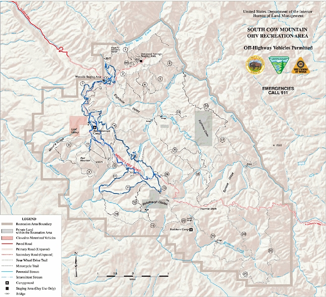 |
| A painstakingly created overlay of the GPS track on top of the official map. |
| Total images: 11 | Last update: 5/18/09 8:57 PM | Help |
|
|
|
| A painstakingly created overlay of the GPS track on top of the official map. |
| Total images: 11 | Last update: 5/18/09 8:57 PM | Help |